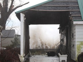
Strong winds, flooding expected along shoreline: LTVCA
Article content
With a special weather statement in effect, conservation authority officials are closely watching Lake Erie and the Thames River.
Easterly winds could reach above 35 kilometres per hour on Sunday and become more southeasterly, the Lower Thames Valley Conservation Authority stated.
During the afternoon, sustained speeds could reach into the 40 to 45 km/h range, with gusts more than 60 km/h. In the evening, winds are predicted to become more southerly. Overnight, sustained speeds could rise above 50 km/h, with possible gusts of 70 to 90 km/h.
Winds are expected to switch more southwest and then west some time on Monday. For Monday afternoon, peak sustained wind speeds could reach 50 to 60 km/h, with gusts of 70 to 90 km/h. The weather statement suggested gusts of up to 100 km/h could been seen at times along the Erie shoreline on Monday afternoon.
Winds are then predicted to drop off Monday overnight into Tuesday morning.
Heavy rains are in the forecast, with local rainfall totals of 20 to 40 millimetres, likely from late Sunday afternoon through Monday morning.
Lake Erie wave forecasts suggest heights of 1 to 1.5 m on Sunday and 1.5 to two-metre waves on Monday.
Lake St. Clair wave forecasts are calling for waves of one metre or slightly higher on Monday.
While winds are out of the east, mostly Sunday afternoon, there is a risk of flooding and shoreline damage to the community of Shrewsbury on Rondeau Bay and portions of Erieau.
While winds are out of the east and southeast, mostly Sunday afternoon into the evening, east-facing shoreline areas along will see a greater-than-usual risk of shoreline damage and erosion and the possibility of some flooding in low-lying areas, such as around Rose Beach Line and Wheatley.
“There is a strong risk of significant flooding along Erie Shore Drive in Chatham-Kent for much of this event,” officials said. “Erie Shore Drive is impacted by wind events from the southeast through southwest and strong winds from this direction are possible from Sunday afternoon through Monday morning.”
Based on current forecasts, the worst flooding should be expected overnight Sunday, conservation authority officials added. If winds haven’t switched west enough Monday afternoon, there could be another significant period of flooding at that time.
There is also a risk of flooding and shoreline damage along the Lake St. Clair shoreline on Monday, most likely in the afternoon, when the winds shift to the west. The potentially impacted areas would be Lighthouse Cove and the eastern shoreline of the lake in Chatham-Kent.
The Thames River and many smaller waterways have risen over the last few days due to melting snow, but levels are now falling. Most of the snow has now melted out of the lower Thames watershed.
“However, any remaining snow is likely to melt with the warm temperatures and rain and adding to any flooding that might occur,” officials said.
The amount of rain in the forecast is likely to cause ponding and localized flooding throughout the watershed, especially in low-lying areas.
Should the area receive the predicted rainfall amounts, the Lower Thames Valley Conservation Authority expects to operate the McGregor Creek diversion channel to prevent flooding in the south end of Chatham.
“It’s still too early to predict potential impacts of this event on the Thames River itself,” officials said.
Postmedia is committed to maintaining a lively but civil forum for discussion. Please keep comments relevant and respectful. Comments may take up to an hour to appear on the site. You will receive an email if there is a reply to your comment, an update to a thread you follow or if a user you follow comments. Visit our Community Guidelines for more information.